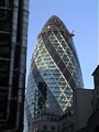
Location of Swiss Re Tower (Gherkin)
Other links to Swiss Re Tower (Gherkin)
Restaurants in the area
Bonds (distance = 410 m bearing 237°)
, Chamberlains (distance = 292 m bearing 222°)
, Grand Café and Bar (distance = 461 m bearing 236°)
, Lanes Restaurant and Bar (distance = 345 m bearing 47°)
Local Pubs
Aldgate Wine Bar (distance = 279 m bearing 122°)
, Bangers Too (distance = 497 m bearing 214°)
, CJs (distance = 433 m bearing 220°)
, Counting Hoouse (distance = 394 m bearing 234°)
, East India Arms (distance = 284 m bearing 124°)
, Elephant and something (distance = 378 m bearing 216°)
, English Club (distance = 446 m bearing 129°)
, Florentines (distance = 497 m bearing 216°)
, Hoop and Graps (distance = 257 m bearing 125°)
, Hung, Drawn and Quartered (distance = 477 m bearing 212°)
, Jamaica Wine House (distance = 366 m bearing 231°)
, Ship, The (distance = 485 m bearing 220°)
, Simpsons (distance = 382 m bearing 232°)
, The Market Trader (distance = 428 m bearing 49°)
, The Pump House (distance = 361 m bearing 214°)
, The Ship (distance = 370 m bearing 215°)
, Three Tons (distance = 333 m bearing 138°)
, Wine Lodge (distance = 391 m bearing 217°)
Shops in the area
Leadenhall (distance = 274 m bearing 223°)
Nearby sights
122 Leadenhall Street (distance = 271 m bearing 227°)
, 20 Fenchurch Street (distance = 411 m bearing 217°)
, Bishopsgate Church Yard (distance = 295 m bearing 309°)
, Blomfield Street (distance = 443 m bearing 312°)
, George Yard - Barclays Bank (distance = 418 m bearing 229°)
, Royal Exchange (distance = 465 m bearing 236°)
, Tower 42 (distance = 235 m bearing 325°)
, Old Turkish Baths (distance = 272 m bearing 308°)
, All Hallows London Wall (distance = 352 m bearing 314°)
, Austin-Friars (distance = 358 m bearing 325°)
, Gray's Inn Chapel (distance = 358 m bearing 325°)
, Spanish and Portuguese Synagogue (distance = 93 m bearing 145°)
, St Andrew Undershaft (distance = 96 m bearing 211°)
, St Botolph Bishopsgate (distance = 255 m bearing 304°)
, St Botolph without Aldgate (distance = 309 m bearing 147°)
, St Edmund the King (distance = 453 m bearing 230°)
, St Ethelburga the Virgin (distance = 137 m bearing 314°)
, St Helen's (distance = 75 m bearing 324°)
, St Katherine Cree (distance = 176 m bearing 135°)
, St Margaret Pattens (distance = 439 m bearing 214°)
, St Michael Cornhill (distance = 365 m bearing 232°)
, St Olave (distance = 441 m bearing 122°)
, St Peter upon Cornhill (distance = 332 m bearing 231°)
, Carpenters Hall (distance = 442 m bearing 321°)
, Drapers Hall (distance = 397 m bearing 327°)
, Liverpool Street Station (distance = 457 m bearing 302°)
, Lloyds (distance = 222 m bearing 220°)
, Lloyds Register (distance = 292 m bearing 126°)
, Osborne House - Nation Association of Flowe Arrangers (distance = 272 m bearing 34°)
, London Underwriter Centre - Minster Court (distance = 476 m bearing 211°)
, Leadenhall Market (distance = 283 m bearing 224°)
, Bartman, Alderman William (distance = 409 m bearing 236°)
, Peabody, George (distance = 415 m bearing 236°)
, Reuter, Paul Julius (distance = 417 m bearing 235°)
, City - Views (distance = 450 m bearing 327°)
, Austin Friars Square (distance = 337 m bearing 322°)
, Broad Street Avenue (distance = 376 m bearing 310°)
, Broadgate (distance = 488 m bearing 306°)
, Devonshire Square (distance = 240 m bearing 33°)
, Mitre Square (distance = 162 m bearing 143°)
, St Helen's Place (distance = 122 m bearing 319°)
, St Michaels Alley (distance = 380 m bearing 231°)
, Throgmorton Avenue (distance = 427 m bearing 326°)
, Widegate Street - Spitalfields (distance = 440 m bearing 38°)
Nearby Neighbours (Plaques)
MALLON, Dr Jimmy, CH (1874-1961), (distance = 237 m bearing 50°)
, ROSENBERG, Isaac (1890-1918), (distance = 482 m bearing 57°)
, STRYPE STREET. (distance = 389 m bearing 46°)
Notorious sights in the area
Baltic Exchange - Bomb (distance = 8 m bearing 31°)
, Bethlehem Hospital (Bedlam)- Liverpool Street Station (distance = 455 m bearing 302°)
, Bishopsgate - Bomb (distance = 193 m bearing 305°)
, Jack the Ripper - Catherine Eddowes (distance = 201 m bearing 142°)
, Liverpool Street Station - Plague Graveyard (distance = 455 m bearing 302°)
, Stock Exchange Bomb (distance = 425 m bearing 237°)
, Walsingham, Sir Francis (1532-1590) - Spys (distance = 473 m bearing 122°)
General Links
Local Map
Map of what is in the area - using Google map