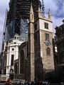
Location of St Andrew Undershaft
Other links to St Andrew Undershaft
Restaurants in the area
Bonds (distance = 400 m bearing 327°)
, Chamberlains (distance = 222 m bearing 228°)
, Grand Café and Bar (distance = 441 m bearing 237°)
, Lanes Restaurant and Bar (distance = 416 m bearing 42°)
Local Pubs
Aldgate Wine Bar (distance = 188 m bearing 124°)
, All Bar One (distance = 454 m bearing 123°)
, Balls Brothers (distance = 419 m bearing 216°)
, Bangers Too (distance = 406 m bearing 215°)
, Bill Bentleys (distance = 480 m bearing 221°)
, CJs (distance = 355 m bearing 223°)
, Counting Hoouse (distance = 364 m bearing 237°)
, East India Arms (distance = 203 m bearing 129°)
, El Vino (distance = 490 m bearing 223°)
, Elephant and something (distance = 292 m bearing 219°)
, English Club (distance = 376 m bearing 133°)
, Florentines (distance = 409 m bearing 218°)
, Fuegos (distance = 429 m bearing 218°)
, Hoop and Graps (distance = 177 m bearing 130°)
, Hung, Drawn and Quartered (distance = 381 m bearing 212°)
, Jamaica Wine House (distance = 324 m bearing 236°)
, Red Lion (distance = 438 m bearing 229°)
, Ship, The (distance = 407 m bearing 224°)
, Simpsons (distance = 345 m bearing 236°)
, The Market Trader (distance = 494 m bearing 45°)
, The Pump House (distance = 269 m bearing 215°)
, The Ship (distance = 280 m bearing 217°)
, The Weatherspoon (distance = 500 m bearing 126°)
, Three Tons (distance = 297 m bearing 145°)
, Wine Lodge (distance = 307 m bearing 220°)
Shops in the area
Leadenhall (distance = 209 m bearing 231°)
Nearby sights
122 Leadenhall Street (distance = 219 m bearing 235°)
, 20 Fenchurch Street (distance = 326 m bearing 220°)
, Bishopsgate Church Yard (distance = 374 m bearing 305°)
, George Yard - Barclays Bank (distance = 368 m bearing 234°)
, Royal Exchange (distance = 444 m bearing 237°)
, Swiss Re Tower (Gherkin) (distance = 96 m bearing 31°)
, Tower 42 (distance = 270 m bearing 318°)
, Trinity House (distance = 440 m bearing 129°)
, Trinity Square 10 (distance = 418 m bearing 126°)
, Old Turkish Baths (distance = 354 m bearing 304°)
, All Hallows by the Tower (distance = 492 m bearing 123°)
, All Hallows London Wall (distance = 419 m bearing 310°)
, Austin-Friars (distance = 388 m bearing 320°)
, Gray's Inn Chapel (distance = 388 m bearing 320°)
, Spanish and Portuguese Synagogue (distance = 117 m bearing 48°)
, St Botolph Bishopsgate (distance = 345 m bearing 302°)
, St Botolph without Aldgate (distance = 319 m bearing 56°)
, St Clement Eastcheap (distance = 476 m bearing 228°)
, St Dunstan in the East (distance = 452 m bearing 212°)
, St Edmund the King (distance = 404 m bearing 234°)
, St Ethelburga the Virgin (distance = 212 m bearing 305°)
, St Helen's (distance = 136 m bearing 306°)
, St Katherine Cree (distance = 141 m bearing 147°)
, St Margaret Pattens (distance = 347 m bearing 215°)
, St Mary at Hill (distance = 445 m bearing 216°)
, St Michael Cornhill (distance = 325 m bearing 236°)
, St Olave (distance = 348 m bearing 122°)
, St Peter upon Cornhill (distance = 292 m bearing 236°)
, Carpenters Hall (distance = 489 m bearing 317°)
, Drapers Hall (distance = 416 m bearing 323°)
, Lloyds (distance = 149 m bearing 229°)
, Lloyds Register (distance = 214 m bearing 131°)
, Osborne House - Nation Association of Flowe Arrangers (distance = 365 m bearing 33°)
, London Underwriter Centre - Minster Court (distance = 380 m bearing 211°)
, Leadenhall Market (distance = 220 m bearing 232°)
, Bartman, Alderman William (distance = 393 m bearing 327°)
, Greathead, James Henry (distance = 486 m bearing 237°)
, Merchant Navy and fishing fleets Memorial (distance = 500 m bearing 126°)
, Peabody, George (distance = 395 m bearing 237°)
, Pepys, Samual (distance = 418 m bearing 124°)
, Reuter, Paul Julius (distance = 395 m bearing 237°)
, Tower Hill Scaffold (distance = 485 m bearing 126°)
, Wellington, Duke, Arthur Wellesley (distance = 494 m bearing 237°)
, War Memorial to London Troops (distance = 481 m bearing 237°)
, City - Views (distance = 457 m bearing 325°)
, Austin Friars Square (distance = 380 m bearing 317°)
, Broad Street Avenue (distance = 452 m bearing 307°)
, Devonshire Square (distance = 335 m bearing 32°)
, Mitre Square (distance = 162 m bearing 56°)
, St Helen's Place (distance = 188 m bearing 307°)
, St Michaels Alley (distance = 336 m bearing 235°)
, Throgmorton Avenue (distance = 453 m bearing 322°)
Nearby Neighbours (Plaques)
CLAYTON, Reverend P.T.B. Tubby (1885-1972), (distance = 423 m bearing 125°)
, MALLON, Dr Jimmy, CH (1874-1961), (distance = 302 m bearing 44°)
, STRYPE STREET. (distance = 461 m bearing 42°)
Notorious sights in the area
Baltic Exchange - Bomb (distance = 88 m bearing 31°)
, Bishopsgate - Bomb (distance = 281 m bearing 303°)
, Great Fire Of London - Disaster (distance = 476 m bearing 220°)
, Jack the Ripper - Catherine Eddowes (distance = 190 m bearing 57°)
, Mr Lloyds coffee house (distance = 433 m bearing 121°)
, Stock Exchange Bomb (distance = 426 m bearing 326°)
, Tower Street Explosion (distance = 433 m bearing 121°)
, Walsingham, Sir Francis (1532-1590) - Spys (distance = 382 m bearing 123°)
General Links
Local Map
Map of what is in the area - using Google map